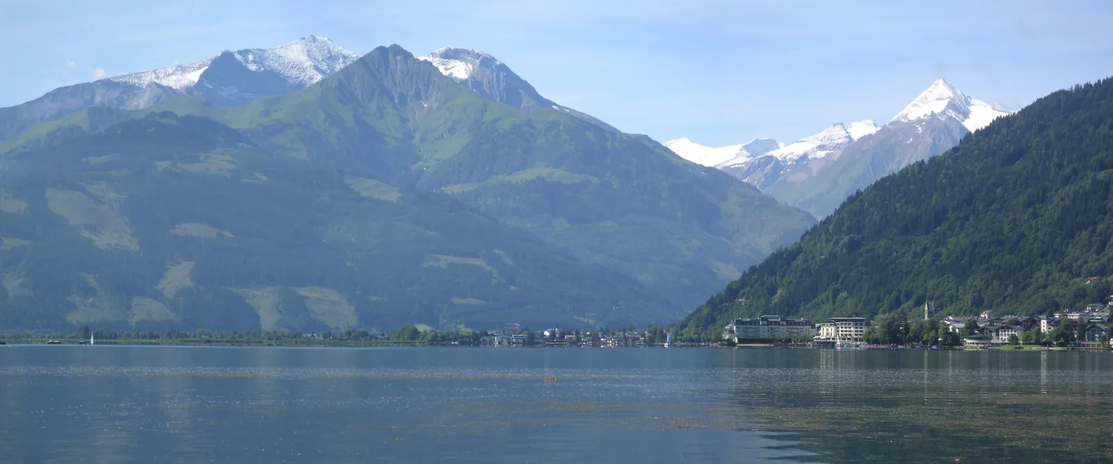
From Zell am See in Austria to Chur in Switzerland via some of Europe's finest mountain roads
A free driving guide for sports-car road trips through the Alps
AustriaItalySwitzerland
Five driving days and an optional sixth over some of Europe's finest mountain roads – Grossglockner, the Dolomites, Stelvio, Bernina and Splügen. Each day has its route, map, elevation profile, stops and hotel suggestions with secure parking. Drive at your own pace, alone or with others.
Important: All information about roads, pass openings, prices and hotels must be
checked before you book or drive. This is a private, independent guide and is not affiliated with
any car maker, car club or hotel.
About the guide
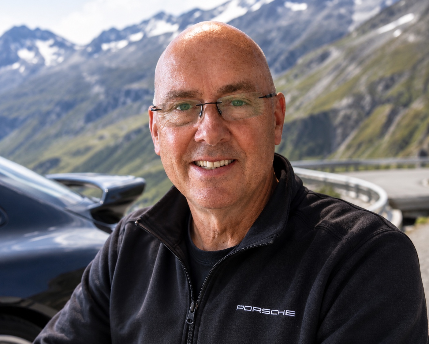
This guide was made by Ian Braastad, owner of a Porsche 996 Turbo and a member of
Porsche Club Norway, Vestre Viken – Asker and Bærum chapter.
The route was planned around a 2001 Porsche 996 Turbo – Basalt Black, 3.6-litre twin-turbo flat-six, 6-speed manual and all-wheel drive – but suits most sports cars. See the tips for sports-car drivers on ground clearance and garage height.
The route is designed to combine enjoyable driving stages, famous mountain passes,
spectacular scenery and overnight stops with secure parking.
The guide is a tribute to great driver's cars and to world-class driving experiences.
It is for anyone who wants to enjoy some of the finest roads in the Alps, whatever they drive.
Enjoy the drive through the Alps!
The complete route
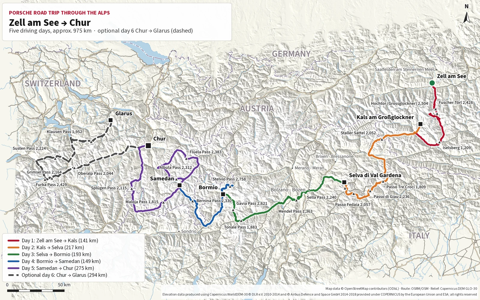
Zell am See → Chur in five days
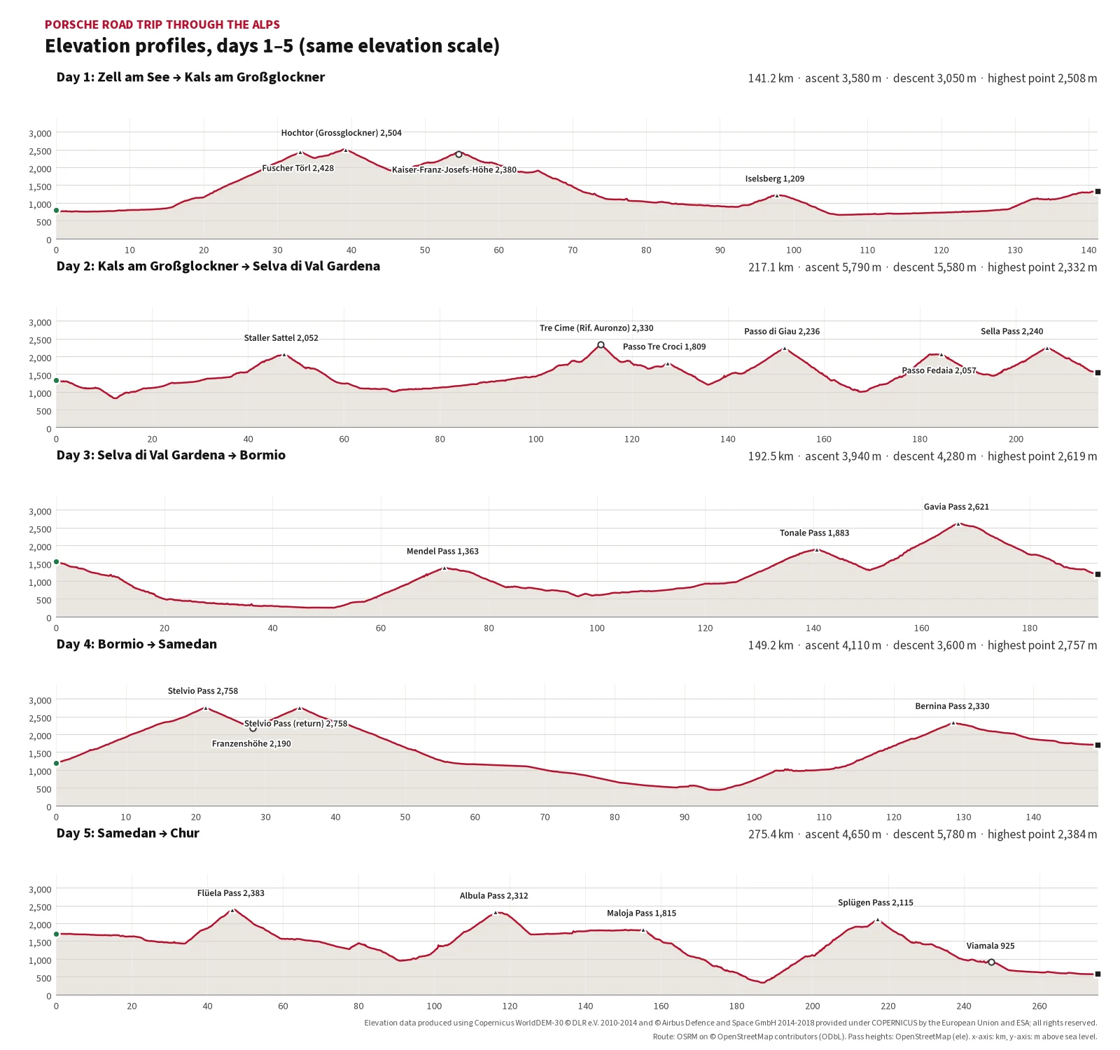
Five driving stages through Austria, Italy and Switzerland, plus an optional sixth day over the classic Swiss passes. Pick a day for its route, map, stops and hotel suggestions.
These suggestions are independent; the guide has no agreement with any of the hotels. Details were taken from the hotels’ own websites or the source stated, in October 2026. Always confirm garage space, height limit, price and minimum stay directly with the hotel before booking.
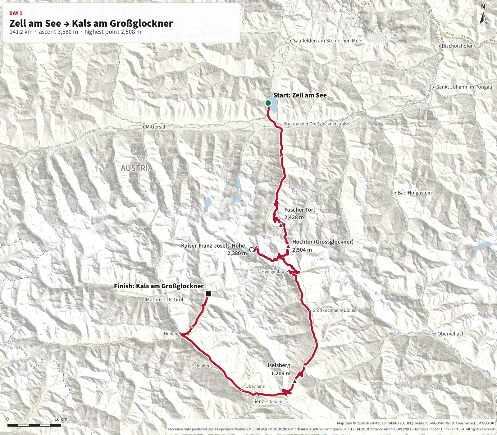
The stage starts in Zell am See and heads south over the Grossglockner High
Alpine Road, including the detour to Kaiser-Franz-Josefs-Höhe.
The route then continues via Heiligenblut, Großkirchheim, Mörtschach, Winklern and Huben
to Kals am Großglockner.
Although pure driving time is under three hours, this should be treated as a full-day stage
with plenty of time for viewpoints, photography, breaks and changing weather conditions.
Toll station for the Grossglockner High Alpine Road.
2
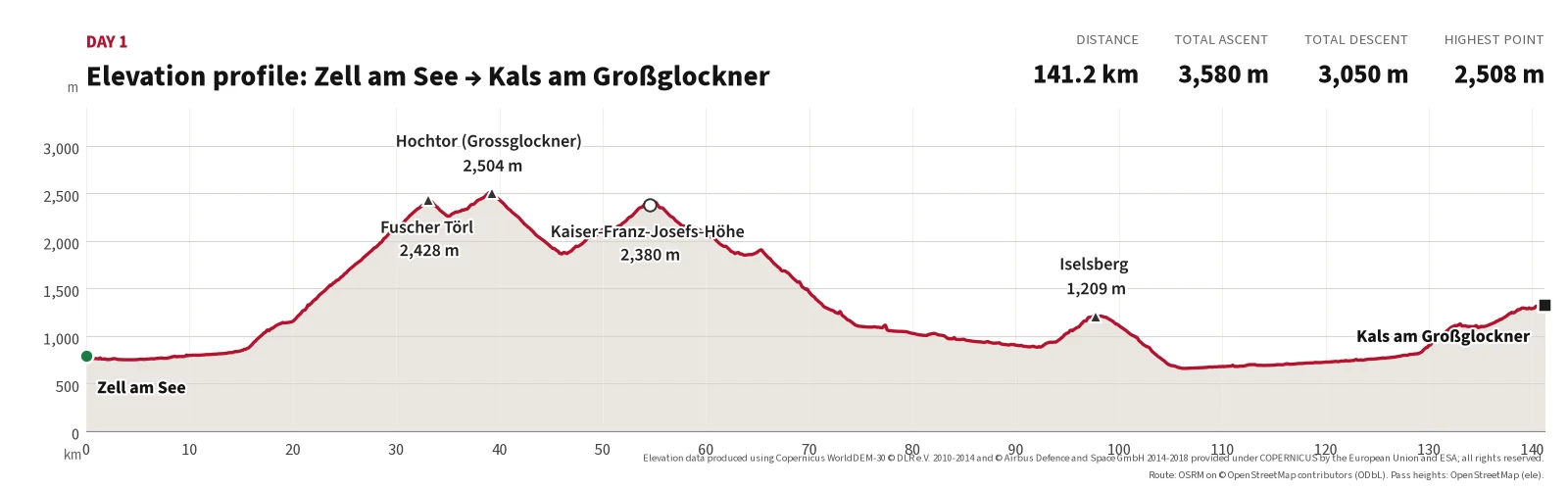
Fuscher Törl
30.9
13.9
2,428 m
Viewpoint on the north side.
3
Hochtor
39.1
8.2
2,504 m
Highest point of the day, tunnel under the pass.
4
Kaiser-Franz-Josefs-Höhe
54.5
15.4
2,369 m
Detour with views of the Großglockner and the Pasterze glacier.
5
Heiligenblut
71.6
17.1
approx. 1,300 m
Village at the southern end of the high road.
Finish
Kals am Großglockner
141.2
69.6
approx. 1,330 m
End of the day.
Main route points for day 1.
Distances calculated along the mapped route (OpenStreetMap data). Pass elevations from signs/OpenStreetMap; other elevations are approximate (Copernicus DEM).
Photos from today's route
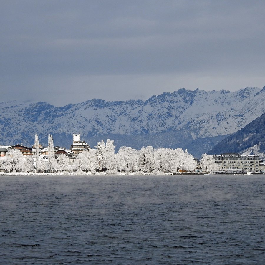
Zell am See – the Zeller See and the town on a winter day, snowy peaks behind.
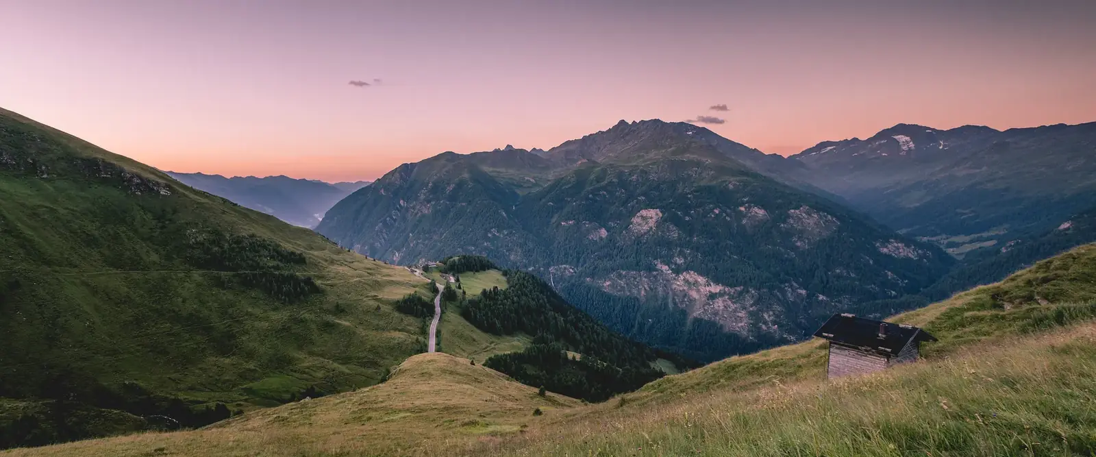
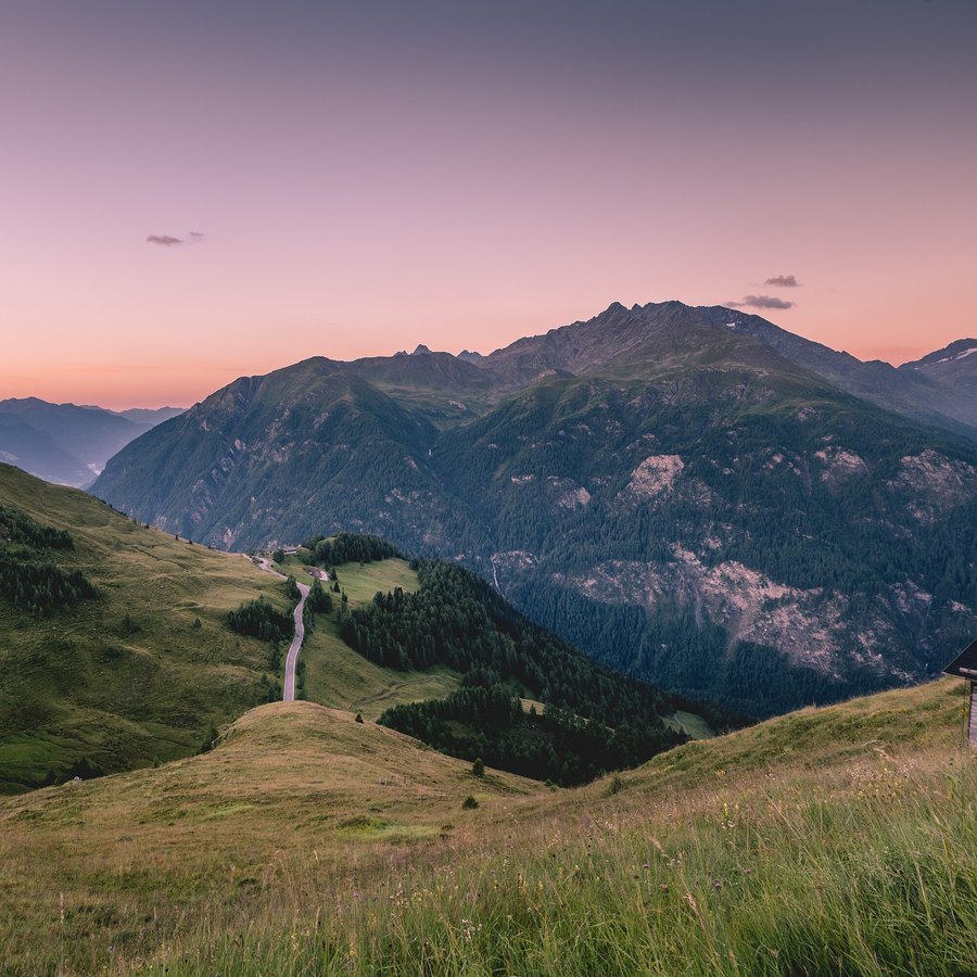
Photo: Wald1siedel / Wikimedia Commons, CC BY-SA 4.0, croppedGrossglockner High Alpine Road – the road winding into the mountains at sunset.
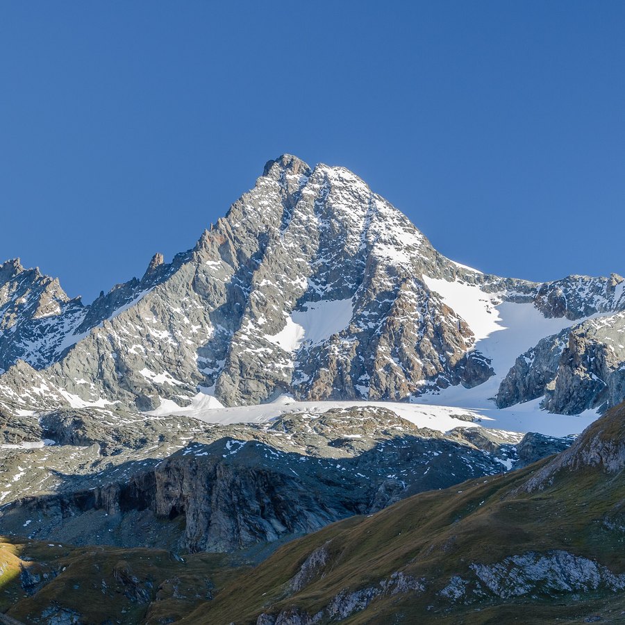
Photo: Karsten Würth (@inf1783) / Unsplash / Wikimedia Commons, CC0, croppedKals am Großglockner – the Großglockner seen from the Lucknerhaus in the Ködnitz valley.
Photo: Florian Fuchs / Wikimedia Commons, CC BY 3.0, cropped
These suggestions are independent; the guide has no agreement with any of the hotels. Details were taken from the hotels’ own websites or the source stated, in October 2026. Always confirm garage space, height limit, price and minimum stay directly with the hotel before booking.
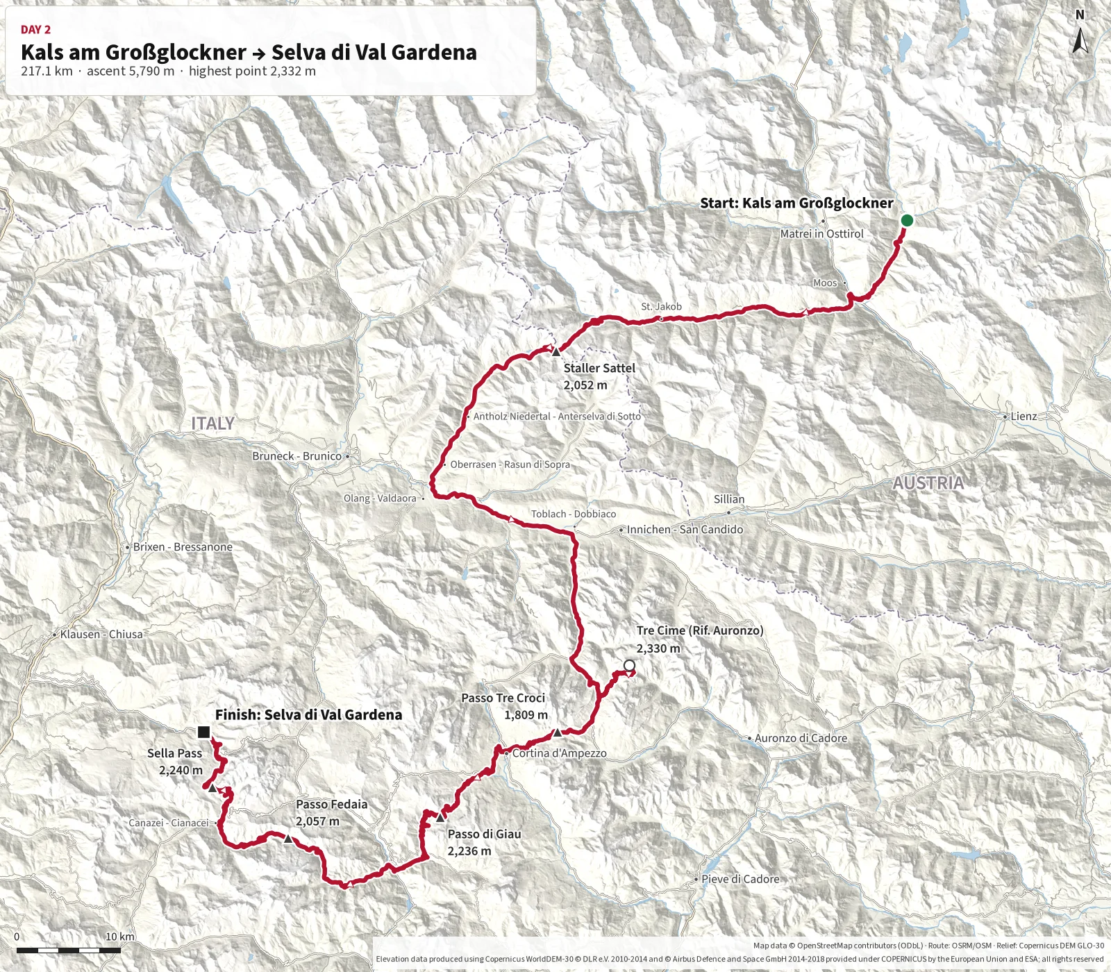
This will be a full and varied driving day through East Tyrol and the Dolomites, featuring several
of the trip's best-known passes and panoramic roads. From Kals the route crosses Staller Sattel,
where traffic is controlled in one direction at a time, before entering Italy and heading towards
the iconic Tre Cime di Lavaredo.
From there, the route takes in the excellent bends of Passo di Giau, views towards Marmolada at
Fedaia and a spectacular finish over Sella Pass to Selva di Val Gardena. Start early and allow the
whole day for viewpoints, photography and short stops.
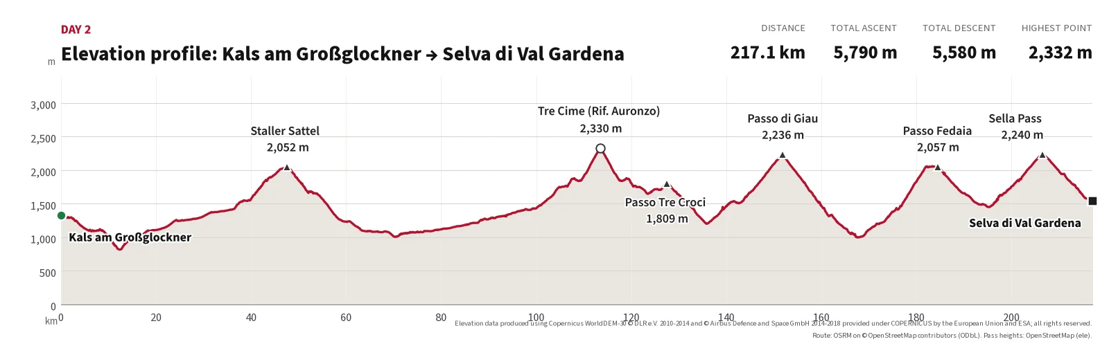
The stage starts in Kals am Großglockner and first crosses Staller Sattel
at 2,052 m. Parts of the mountain road are narrow and use timed one-way traffic.
The route then continues to Tre Cime di Lavaredo (Rifugio Auronzo, approx. 2,330 m, the day's highest point) and over Passo di Giau at 2,236 m.
It passes Lake Fedaia beneath Marmolada and crosses Sella Pass at 2,240 m before finishing in
Sëlva di Val Gardena.
Pure driving time is about five hours, but the stage should be treated as a full day of at least
eight to ten hours. Allow plenty of time for traffic control at Staller Sattel, access and parking
at Tre Cime, viewpoints, photography, meals and changing weather.
Toll road up to Rifugio Auronzo; highest point of the day.
3
Passo di Giau
151.9
38.0
2,236 m
Many hairpins and wide views.
4
Lago di Fedaia
182.9
31.0
approx. 2,050 m
The dam below the Marmolada.
5
Sella Pass
207.5
24.6
2,240 m
Final pass before Val Gardena.
Finish
Selva di Val Gardena
217.1
9.6
approx. 1,540 m
End of the day.
Main route points for day 2.
Distances calculated along the mapped route (OpenStreetMap data). Pass elevations from signs/OpenStreetMap; other elevations are approximate (Copernicus DEM).
Photos from today's route
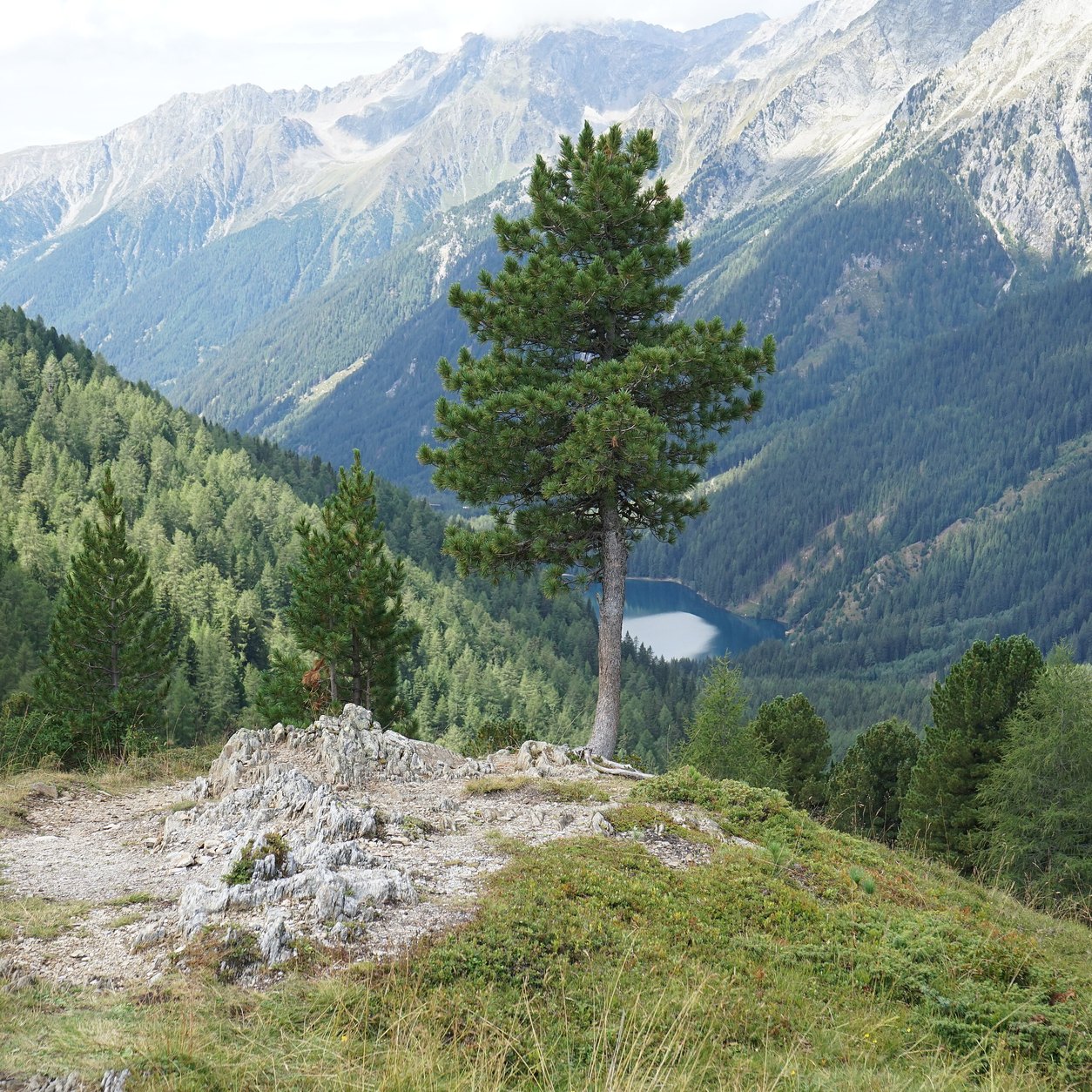
Staller Sattel – a lone tree and snowy peaks above the Defereggen valley.
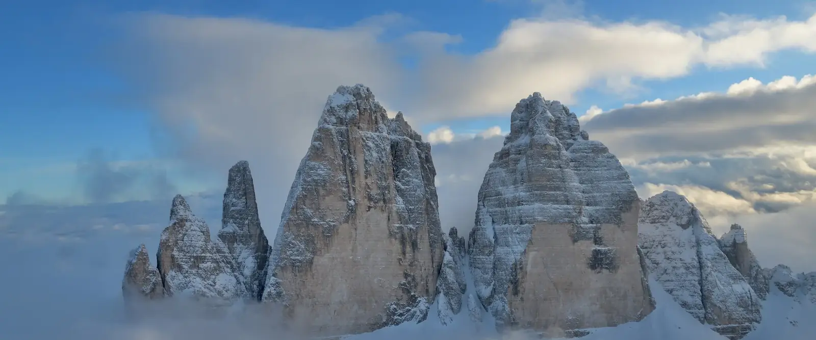
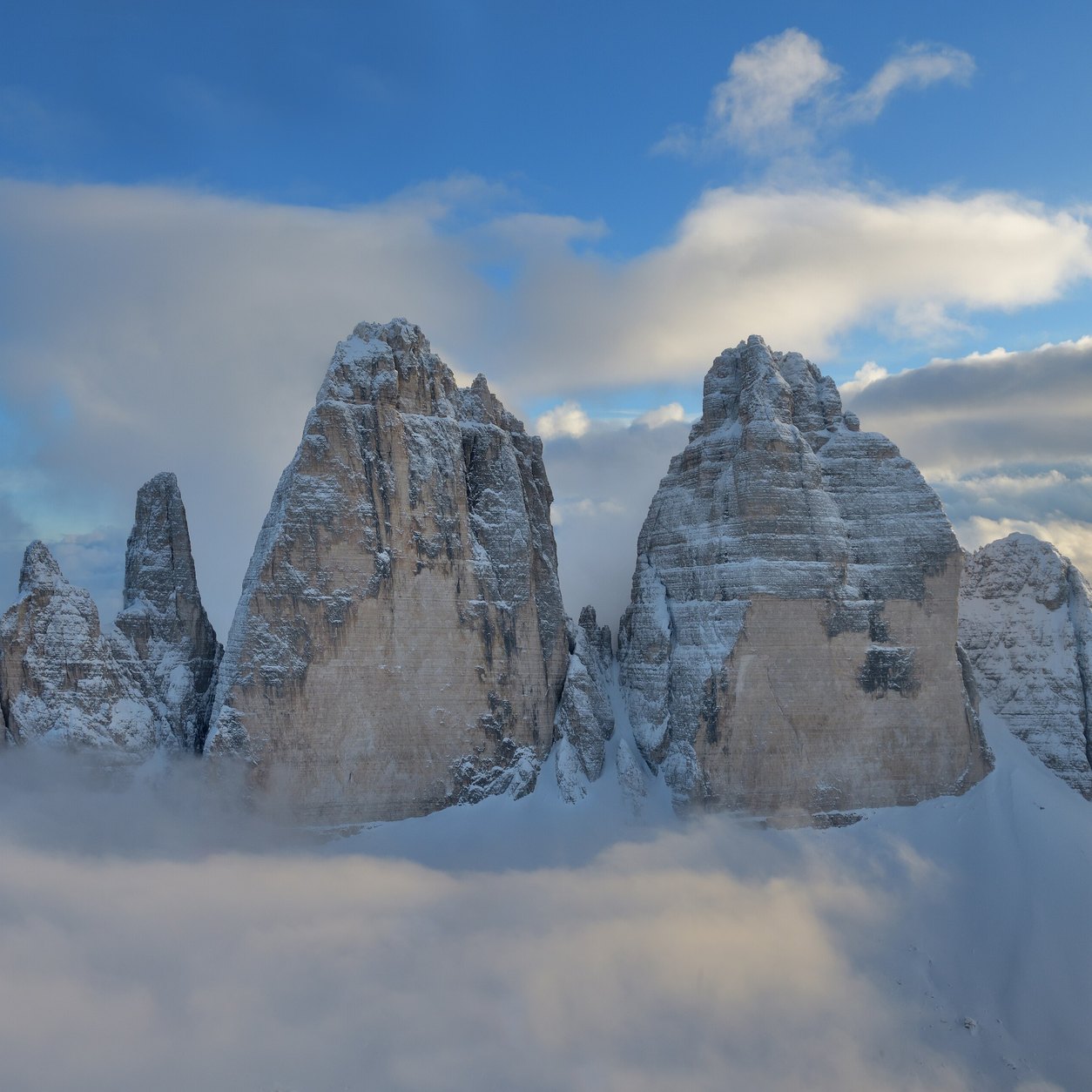
Photo: PantheraLeo1359531 / Wikimedia Commons, CC BY-SA 4.0, croppedTre Cime di Lavaredo – the three peaks rising above a sea of clouds.
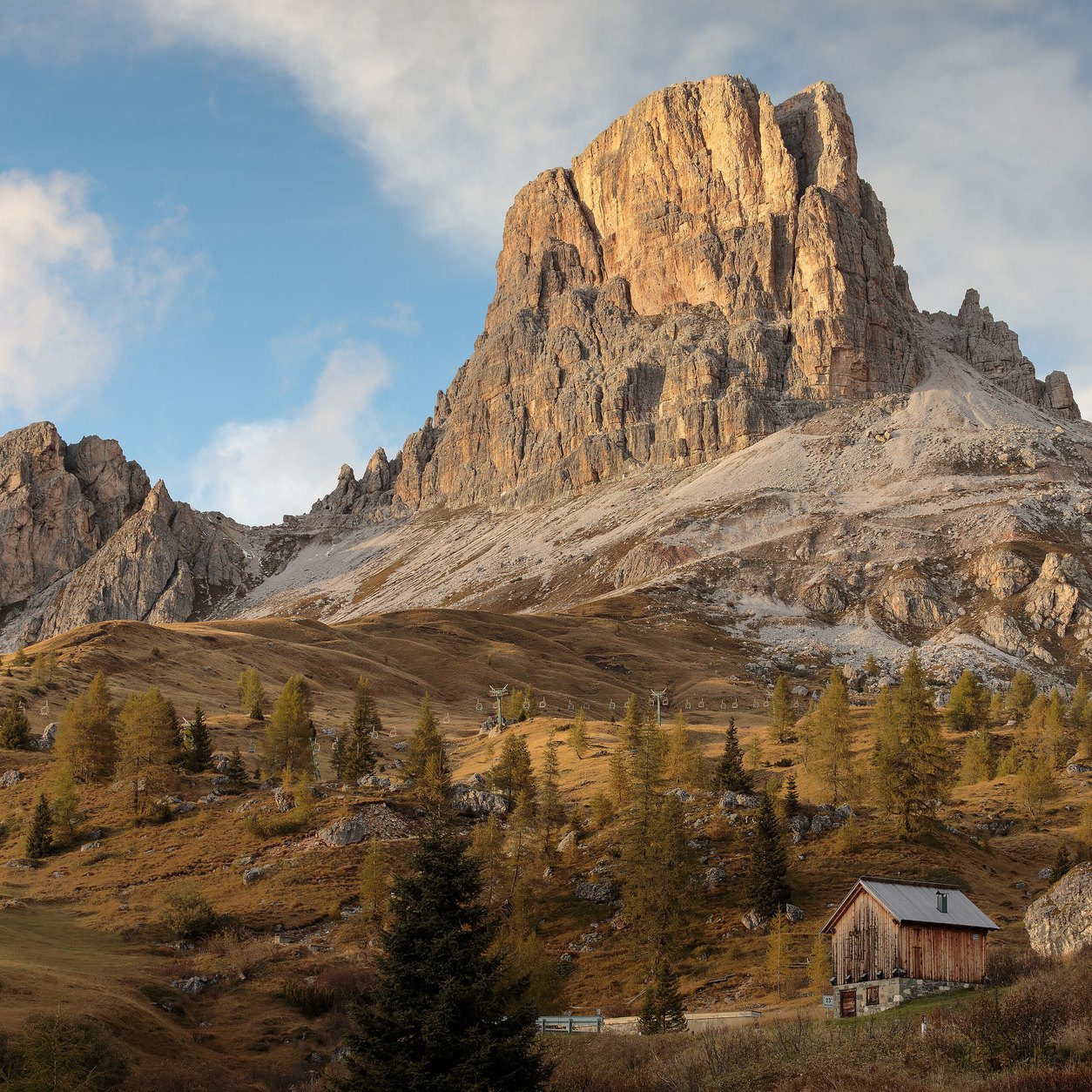
Photo: Wolfgang Moroder / Wikimedia Commons, CC BY-SA 3.0, croppedPasso di Giau – Averau in golden autumn light, seen from Fedare.
Photo: Ximonic (Simo Räsänen) / Wikimedia Commons, CC BY-SA 4.0, cropped
Many hotels in Val Gardena have minimum stays in high season, and several close in late September. The tourist office valgardena.it (info@valgardena.it) can help find available rooms.
Garni Hotel Concordia
Level: budget (garni / B&B)
Address: Puez Straße 10, Selva/Wolkenstein
Parking: Free garage (max. 10 cars) and outdoor parking according to the hotel website.
Short stays: Prices apply to stays of at least 3 nights; a supplement applies for 1–3 nights.
Season: Summer and winter season (dates: check with the hotel).
These suggestions are independent; the guide has no agreement with any of the hotels. Details were taken from the hotels’ own websites or the source stated, in October 2026. Always confirm garage space, height limit, price and minimum stay directly with the hotel before booking.
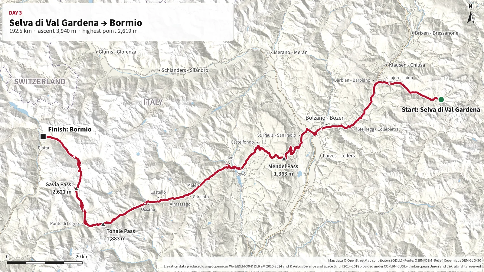
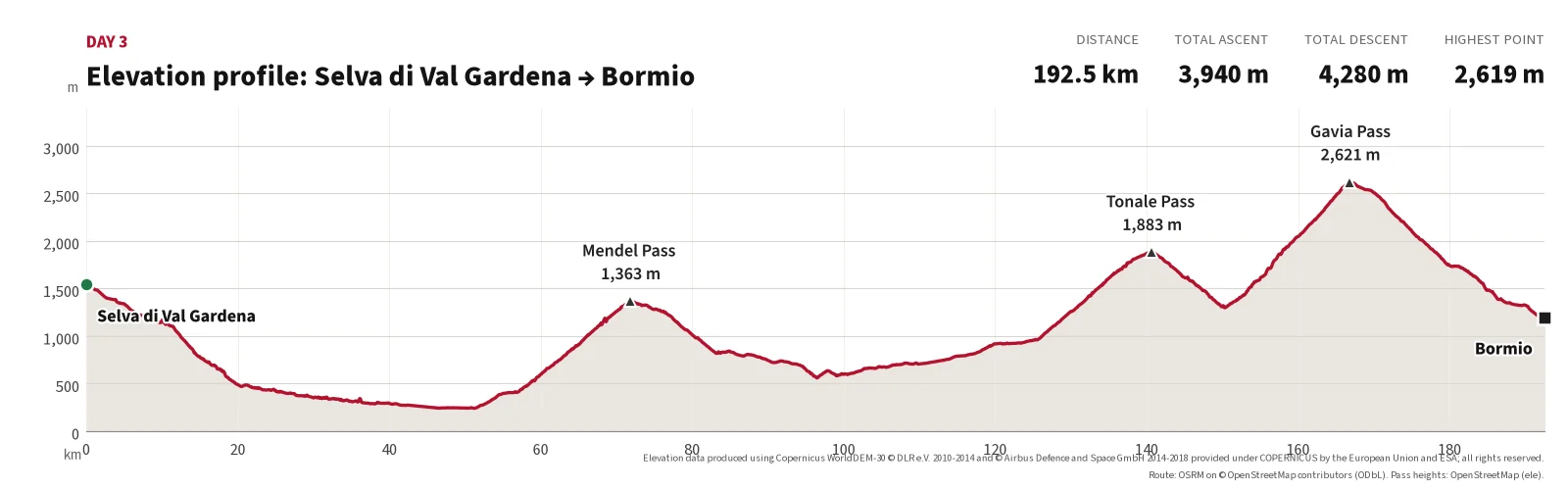
This is one of the trip's most important and varied driving stages, running from the Dolomites to
Bormio in Lombardy. From Selva the route heads west towards Bolzano and climbs the excellent
hairpins to Mendel Pass before continuing through the mountains towards Tonale Pass.
The highlight of the day is Gavia Pass, known for its narrow road, steep mountainsides and dramatic
high-Alpine scenery. Drive carefully and be prepared for oncoming traffic on the narrowest sections.
After descending from Gavia, the day ends in the historic mountain town of Bormio.
The stage starts in Selva di Val Gardena and heads west through the Dolomites
towards Bolzano. After descending to the day's lowest point, the route climbs the hairpins towards
Mendel Pass.
The route continues west to Tonale Pass at around 1,880 m and then on to Gavia Pass, whose narrow
roads and dramatic high-mountain landscape form the highlight of the day at around 2,620 m.
After Gavia there is a long and demanding descent to Bormio, where the stage ends.
Although the pure driving time is under four hours, allow plenty of time for viewpoints, photography,
breaks and careful driving on the narrowest sections.
Highest point of the day; narrow road, especially on the south side.
Finish
Bormio
192.5
25.6
approx. 1,200 m
End of the day.
Main route points for day 3.
Distances calculated along the mapped route (OpenStreetMap data). Pass elevations from signs/OpenStreetMap; other elevations are approximate (Copernicus DEM).
Photos from today's route
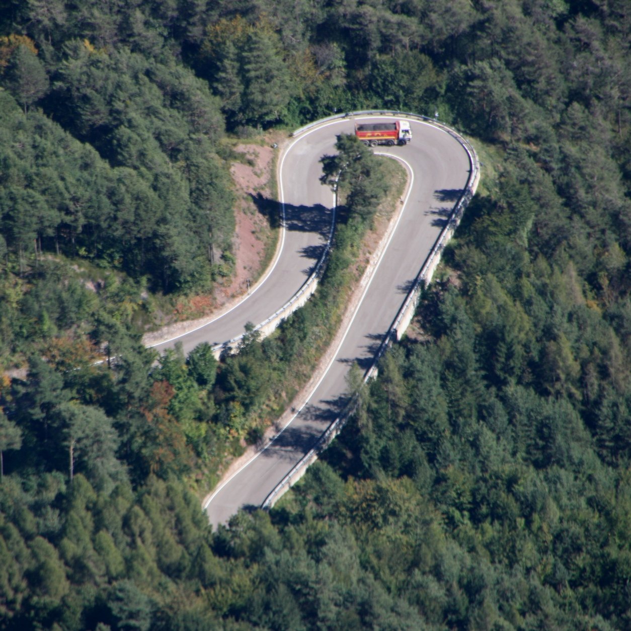
Mendel Pass – hairpin on the eastern ramp, seen from Penegal.
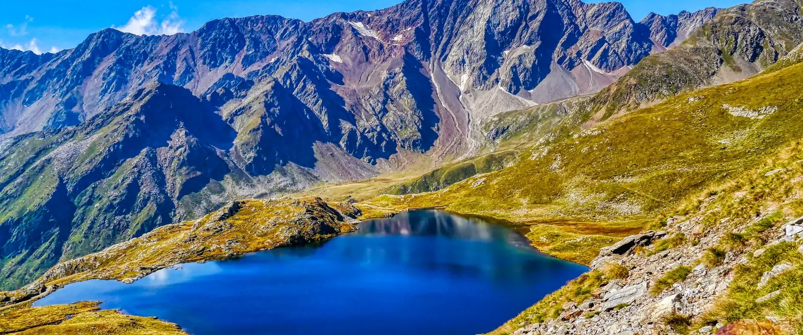
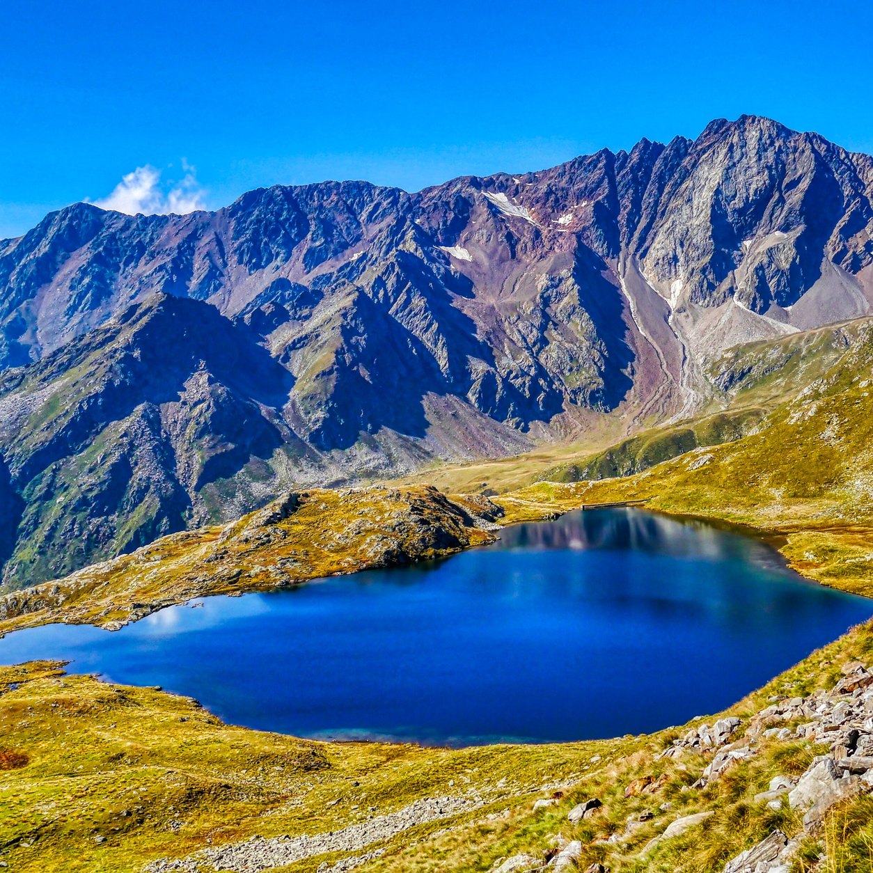
Photo: HaSt / Wikimedia Commons, CC BY-SA 4.0, croppedGavia Pass – Lago Nero on the southern side of the pass.
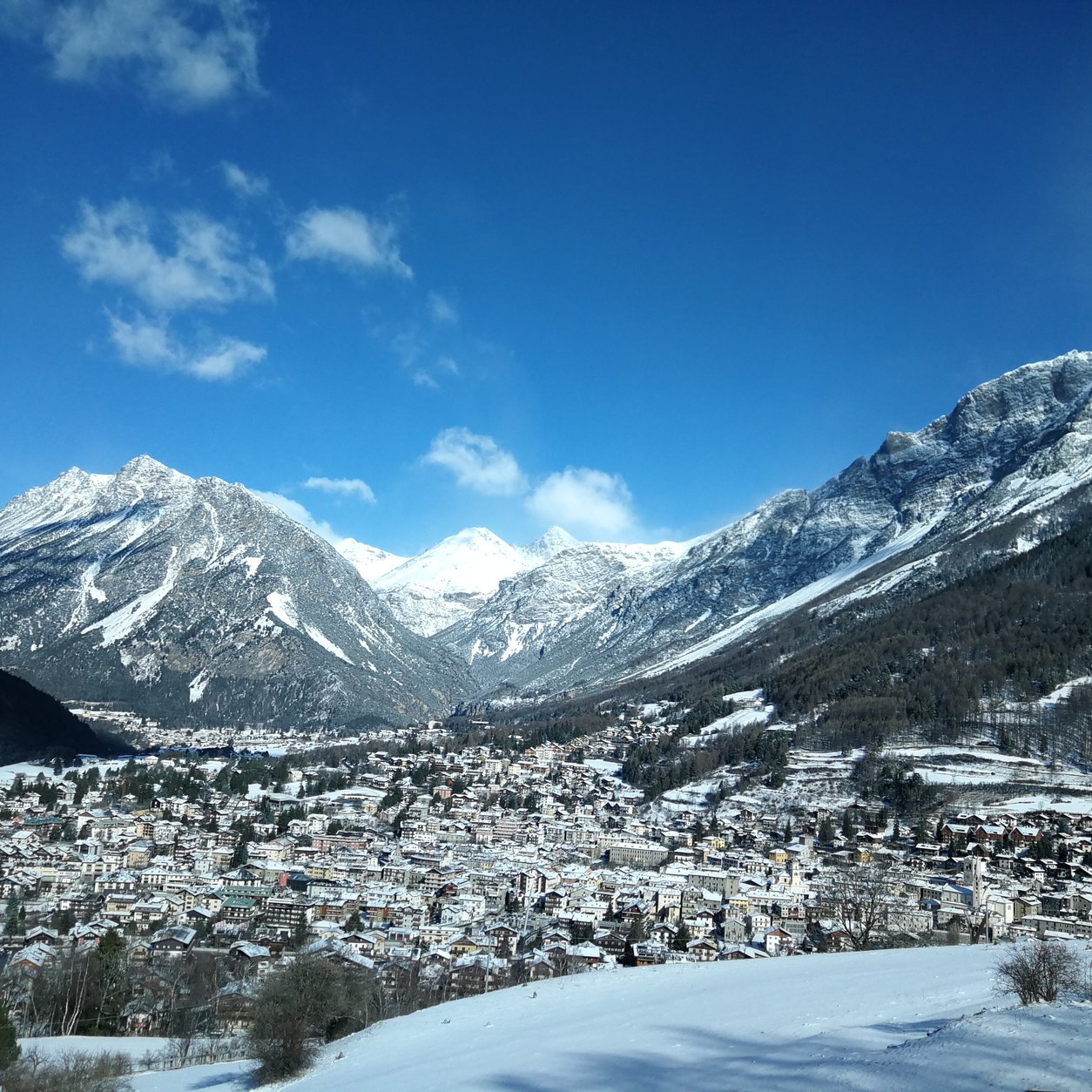
Photo: Zairon / Wikimedia Commons, CC BY-SA 4.0, croppedBormio – the mountain town in the valley below snowy peaks.
Photo: Sauro Sisti / Wikimedia Commons, CC BY-SA 4.0, cropped
These suggestions are independent; the guide has no agreement with any of the hotels. Details were taken from the hotels’ own websites or the source stated, in October 2026. Always confirm garage space, height limit, price and minimum stay directly with the hotel before booking.
Practical information
Check fuel level before entering the mountain roads.
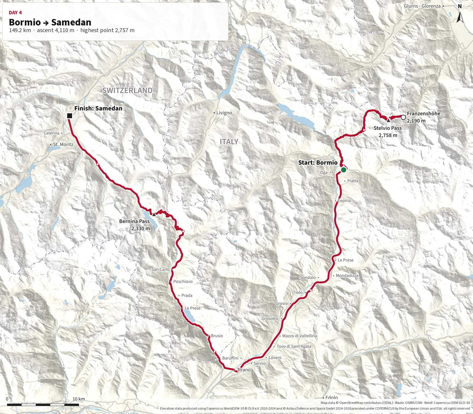
This day is devoted to some of the most famous mountain roads in the Alps. From Bormio the route
climbs to Stelvio Pass and continues down the iconic hairpins on the north-east side to Franzenshöhe. There the route
turns and goes back over Stelvio Pass to Bormio before heading south to Tirano.
From Tirano the road climbs back into Switzerland and over Bernina Pass, with views of Lago Bianco,
glaciers and the Bernina massif. The day ends in Samedan. Allow plenty of time for photography,
breaks and possible traffic around Stelvio – this is a day to enjoy rather than rush.
The stage starts in Bormio and climbs the western side of Stelvio Pass.
After the summit at around 2,758 m, the route continues down the spectacular eastern side to
Berghotel Franzenshöhe.
Franzenshöhe is the turning point. After a break, the route heads back over Stelvio Pass and
descends to Bormio. From there it continues south to Tirano before climbing again into the
high-Alpine landscape via Poschiavo and Bernina Pass.
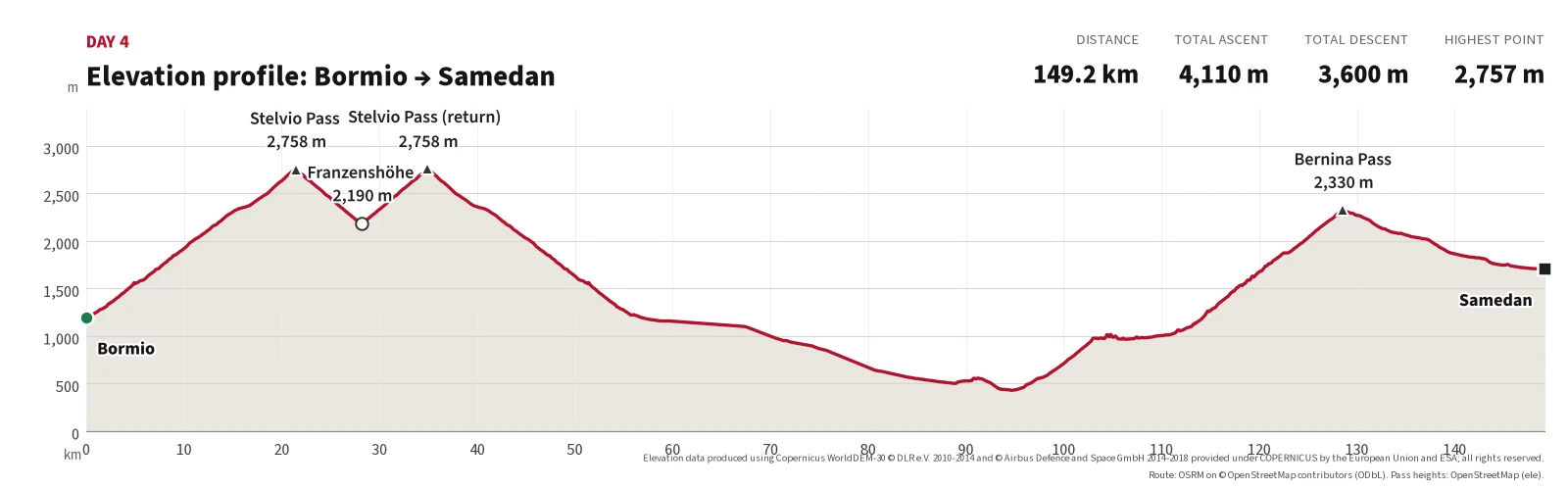
The day ends in Samedan. Although pure driving time is under three hours,
allow approximately five to six hours including stops on Stelvio, a break at Franzenshöhe,
photography, traffic and changing weather.
Highest point of the day; up the west side from Bormio.
2
Franzenshöhe
28.2
6.8
approx. 2,190 m
Turning point after the hairpins on the north-east side; break, then back over the pass.
3
Stelvio Pass (return)
34.9
6.7
2,757 m
Second crossing of the summit.
4
Bormio
56.6
21.7
approx. 1,200 m
Back in Bormio before heading south.
5
Tirano
94.2
37.6
approx. 440 m
Lowest point of the day.
6
Poschiavo
110.4
16.2
approx. 1,010 m
Swiss town on the climb to Bernina.
7
Bernina Pass
128.6
18.2
2,328 m
Lago Bianco and the Bernina railway.
Finish
Samedan
149.2
20.6
approx. 1,710 m
End of the day.
Main route points for day 4.
Distances calculated along the mapped route (OpenStreetMap data). Pass elevations from signs/OpenStreetMap; other elevations are approximate (Copernicus DEM).
Photos from today's route
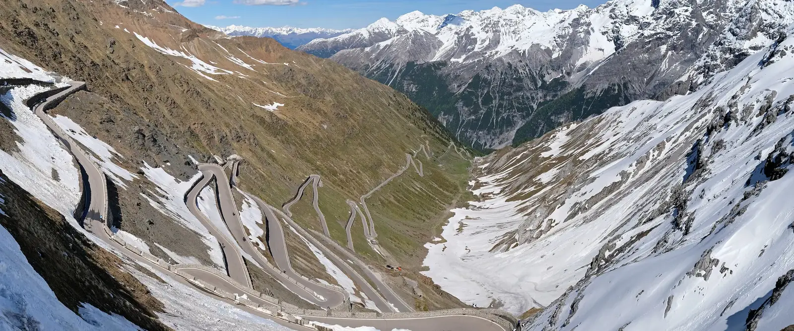
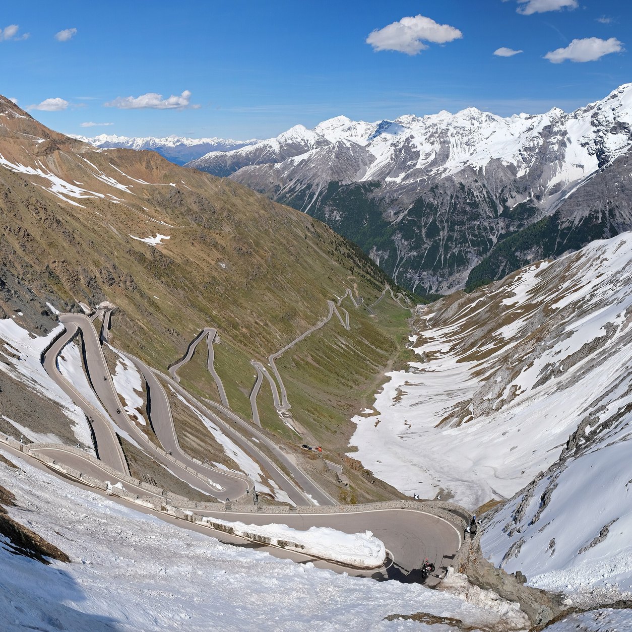
Stelvio – the eastern-side hairpins with snowy mountains.
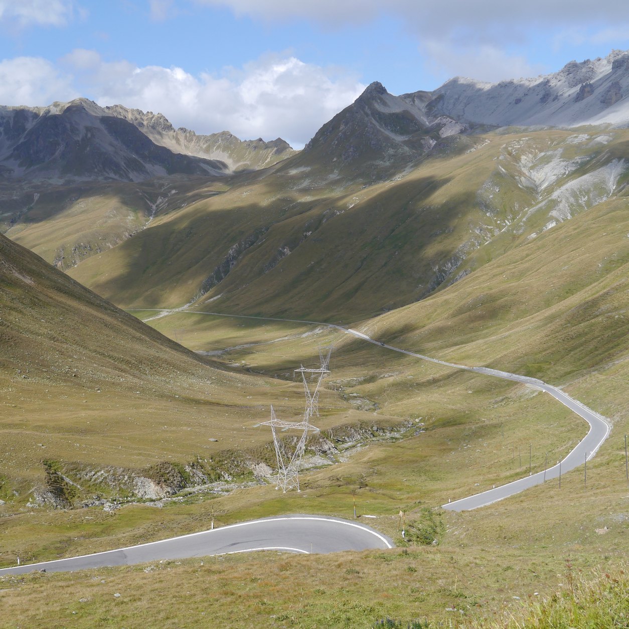
Photo: kallerna / Wikimedia Commons, CC BY-SA 4.0, croppedUmbrail – open and remote high-mountain scenery above Valle del Braulio.
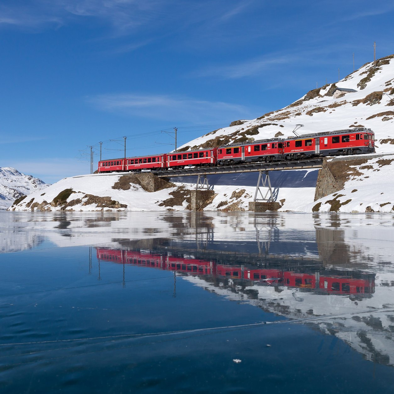
Photo: Zairon / Wikimedia Commons, CC BY-SA 4.0, croppedBernina – the red Bernina Railway train reflected in Lago Bianco.
Photo: Kabelleger / David Gubler / Wikimedia Commons, CC BY-SA 4.0, cropped
Samedan and neighbouring Pontresina are both well placed for the Bernina, Albula and Flüela passes. Swiss hotel garages are often small – check the height limit.
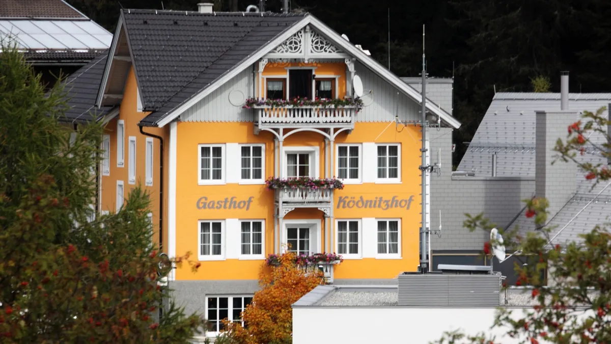
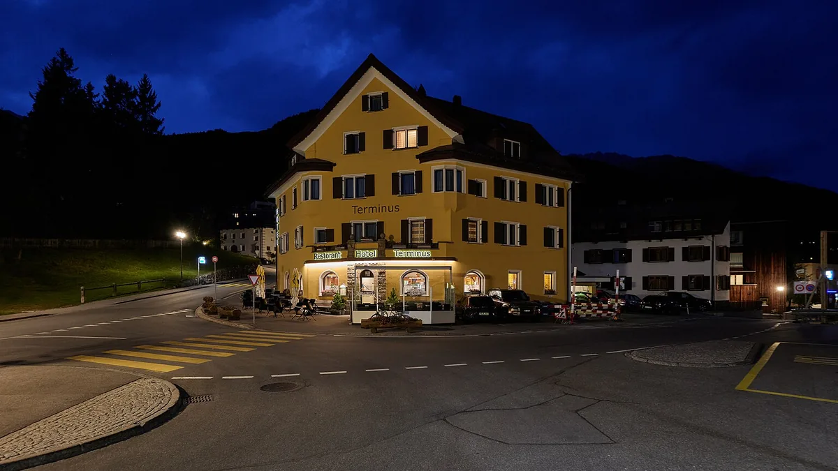
Hotel Terminus
Level: budget/mid-range
Address: Via Retica 24, 7503 Samedan
Parking: Parking is not described on the hotel website – check with the hotel.
These suggestions are independent; the guide has no agreement with any of the hotels. Details were taken from the hotels’ own websites or the source stated, in October 2026. Always confirm garage space, height limit, price and minimum stay directly with the hotel before booking.
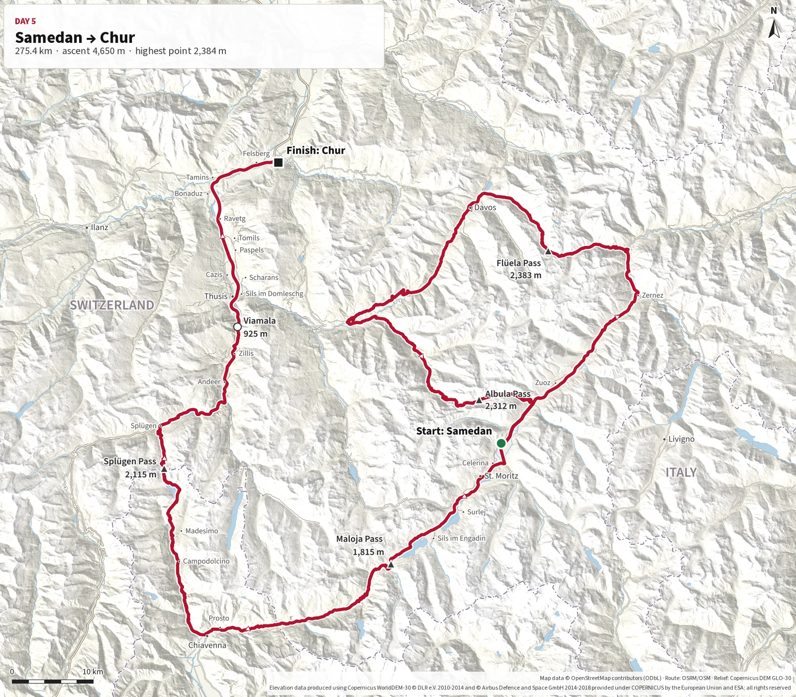
The final day in the Alps is a long and varied stage through some of Switzerland's most beautiful
mountain regions. From Samedan the route heads north over Flüela Pass and towards Davos before
turning south again across Albula Pass and Maloja.
From there the route continues via Chiavenna and the impressive hairpins of Splügen Pass back into
Switzerland. A stop at the dramatic Viamala Gorge provides a fitting finale before the road continues
north to Chur. Start early and allow extra time for stops, photography and changing conditions.
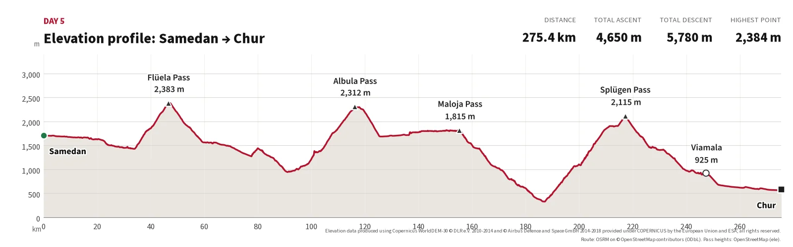
The final Alpine stage starts in Samedan. The route first heads north to
Flüela Pass at 2,383 m and continues towards Davos before turning south again towards Albula Pass
at 2,312 m.
From Albula the route continues through the Engadin and over Maloja Pass. After the long descent
towards Chiavenna, another major climb begins to Splügen Pass at 2,113 m before the route returns
to Switzerland.
The final section passes through the dramatic Viamala Gorge and continues north to Chur.
With several mountain passes, large elevation changes and many natural stopping points, this should
be planned as a full day of approximately eight to ten hours.
Many hairpins on the Italian side; border with Switzerland.
7
Viamala
247.4
30.1
approx. 920 m
Gorge with viewpoint.
Finish
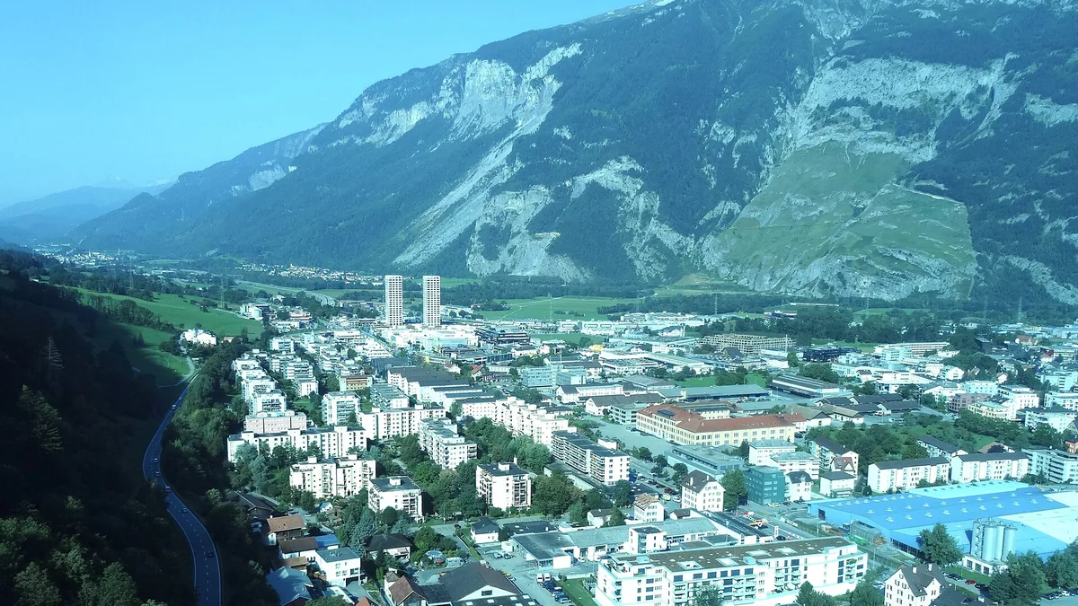
Chur
275.4
28.0
approx. 580 m
End of the day.
Main route points for day 5.
Distances calculated along the mapped route (OpenStreetMap data). Pass elevations from signs/OpenStreetMap; other elevations are approximate (Copernicus DEM).
Photos from today's route
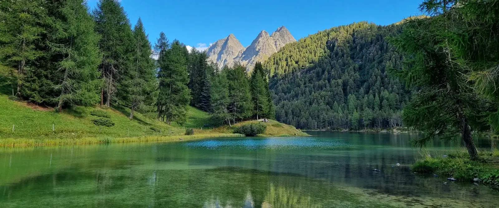
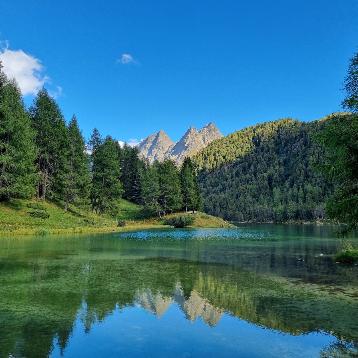
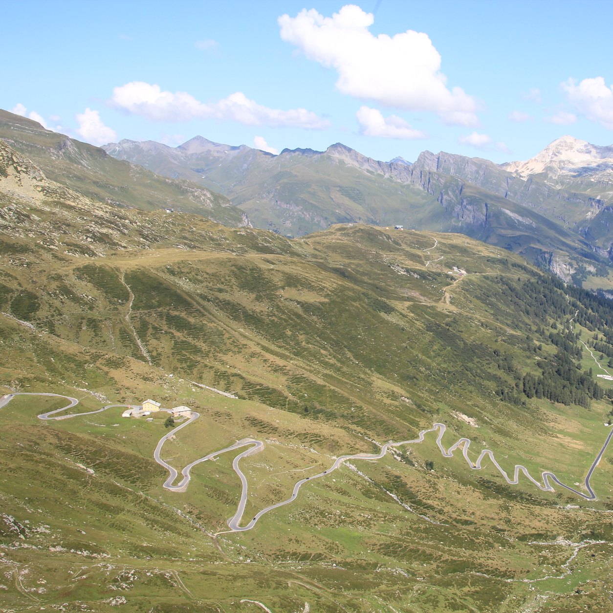
Albula – the turquoise Lai da Palpuogna beside the pass road.
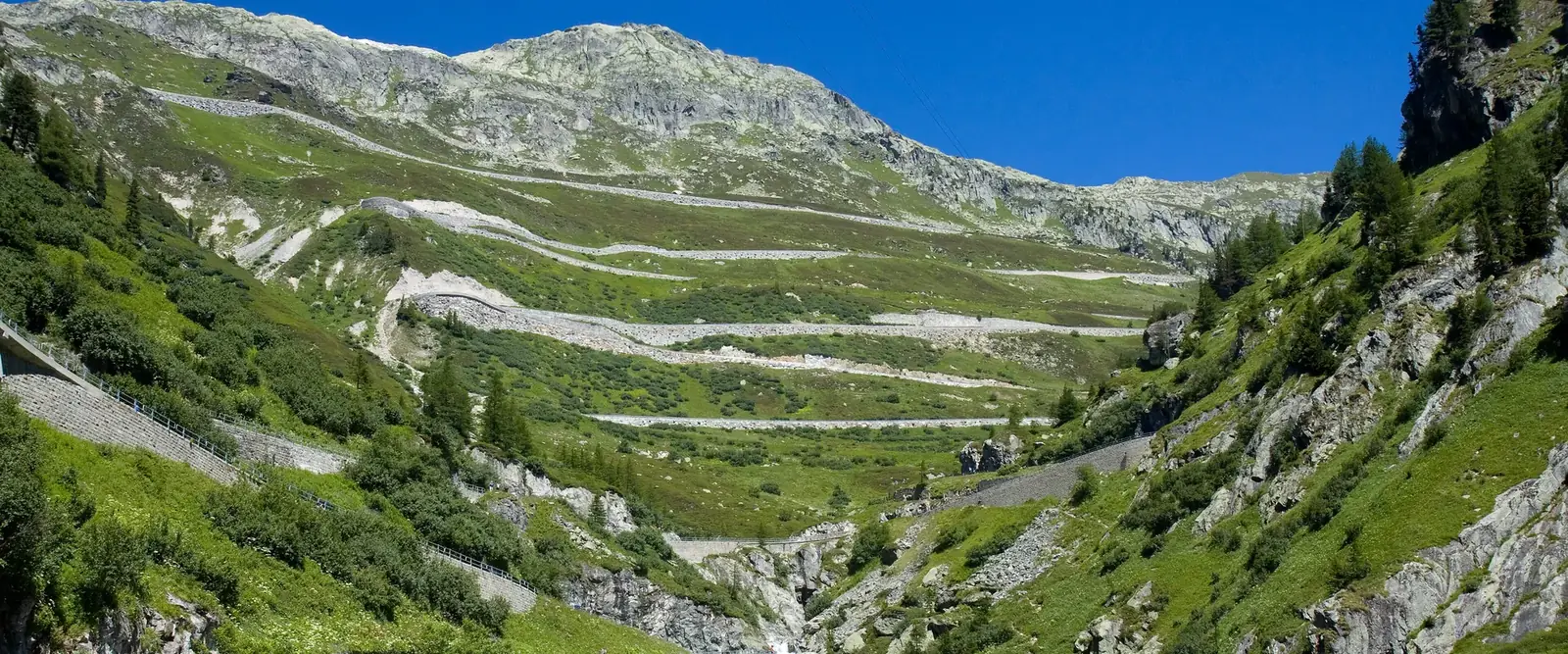
Photo: Staublex / Wikimedia Commons, CC BY-SA 4.0, croppedSplügen – hairpins above the Rheinwald valley.
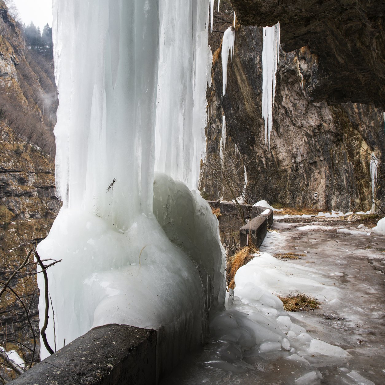
Photo: Adrian Michael / Wikimedia Commons, CC BY 2.5, croppedViamala – frozen icefalls in the gorge in winter.
Photo: Sharif Emam / Wikimedia Commons, CC BY-SA 4.0, cropped
These suggestions are independent; the guide has no agreement with any of the hotels. Details were taken from the hotels’ own websites or the source stated, in October 2026. Always confirm garage space, height limit, price and minimum stay directly with the hotel before booking.
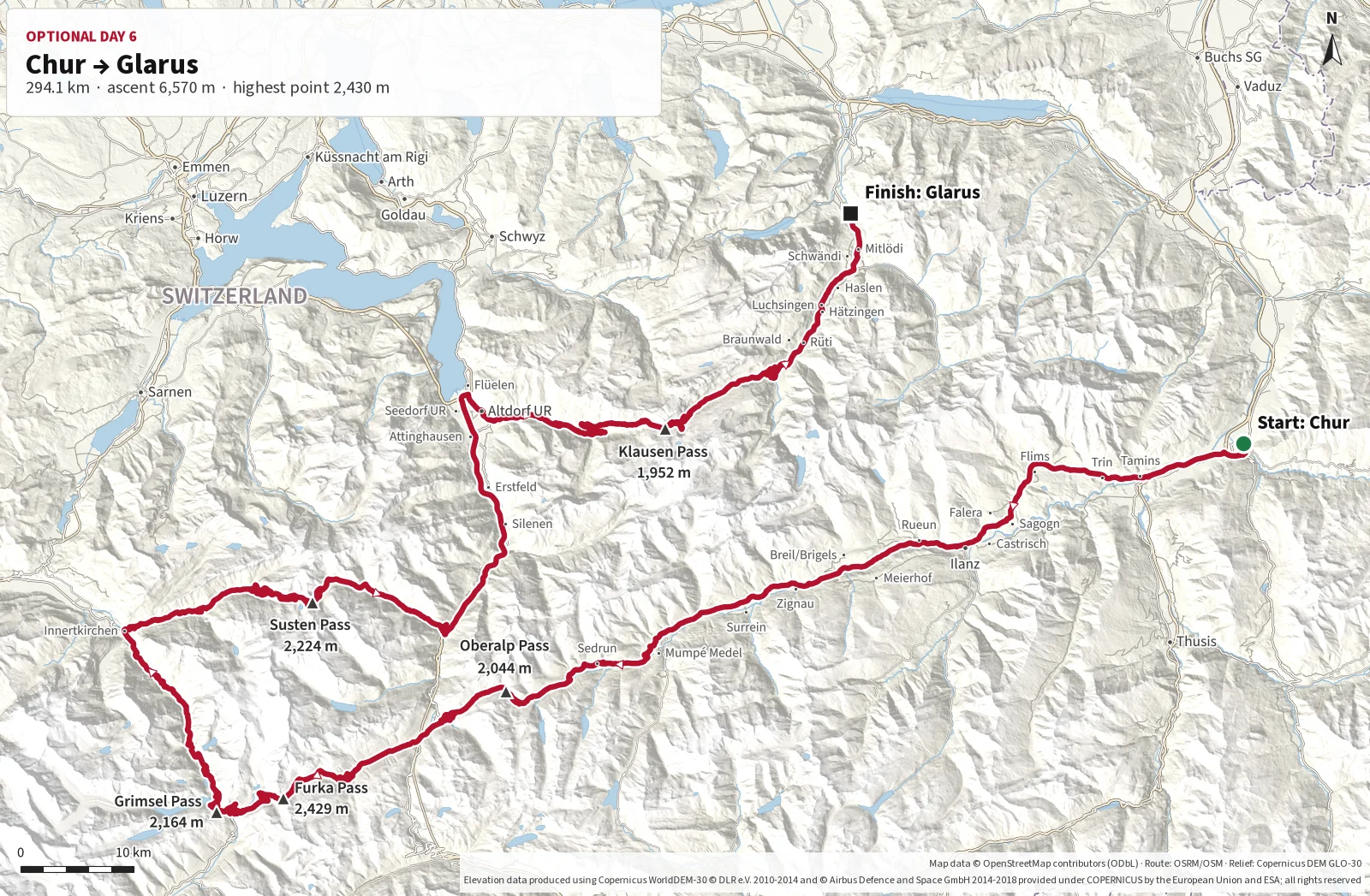
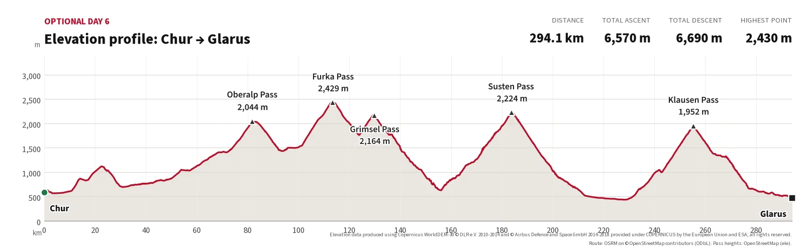
If you would like one more driving day, you can extend the trip with a spectacular route
through central Switzerland. From Chur the route crosses Oberalp Pass, Furka Pass, Grimsel Pass
and Susten Pass before continuing via Altdorf and Klausen Pass to Glarus.
This is a long and demanding high-mountain stage with six well-known passes, large elevation
changes and some of Switzerland's finest Alpine scenery. The route combines open high mountain
landscapes, glaciers, reservoirs, hairpins, tunnels and deep Alpine valleys.
The calculated driving time is around four hours without stops, but the route should be treated
as a full driving day. Allow plenty of time for breaks, photography, traffic and changing weather.
The optional stage finishes in Glarus. Plan your overnight stay in the area and
onward journey in advance. The route should only be driven if all the mountain passes
are open and weather conditions are suitable.
The first major climb from Chur, through Graubünden and west towards Andermatt.
2,044 m2
Furka Pass
One of Switzerland's most famous mountain passes and the highest point of the optional stage.
2,429 m3
Grimsel Pass
A dramatic high-mountain road surrounded by mountains, reservoirs and rugged scenery.
2,164 m4
Susten Pass
A superb mountain road with long bends, tunnels and views towards glaciers and Alpine valleys.
2,224 m5
Altdorf
A natural stop in the valley before the final major climb over Klausen Pass.
Approx. 455 m6
Klausen Pass
The final mountain pass of the day, with narrow sections, large elevation changes and excellent views on the way to Glarus.
1,952 m
Stops on optional day 6 from Chur to Glarus
Stop
Place
Km from start
From previous
Elevation
Note
Start
Chur
0.0
–
approx. 590 m
Start after arrival in Chur.
1
Oberalp Pass
81.8
81.8
2,044 m
First major climb, west towards Andermatt.
2
Furka Pass
113.5
31.7
2,429 m
Highest point of the optional stage.
3
Grimsel Pass
129.9
16.4
2,164 m
High-mountain road with massifs and reservoirs.
4
Susten Pass
183.8
53.9
2,224 m
Long bends, tunnels and glacier views.
5
Altdorf
230.1
46.3
approx. 455 m
Natural stop in the valley before Klausen Pass.
6
Klausen Pass
255.3
25.2
1,952 m
Final pass of the day, with narrow sections.
Finish
Glarus
294.1
38.8
approx. 470 m
The optional stage ends; arrange your own overnight stay and journey home.
Main route points from Chur to Glarus.
Distances calculated along the route shown on the map above (OpenStreetMap data). Pass elevations as in the pass cards; elevations for Chur, Altdorf and Glarus are approximate.
These suggestions are independent; the guide has no agreement with any of the hotels. Details were taken from the hotels’ own websites or the source stated, in October 2026. Always confirm garage space, height limit, price and minimum stay directly with the hotel before booking.
Important before departure
Check that all mountain passes are open.
Check the weather, temperature, fog and any risk of snow.
Start early and allow the whole day for the stage.
Fill up before the longest mountain sections.
Allow extra time for breaks, photography and traffic.
Plan an overnight stay in or around Glarus in advance.
Have an alternative route available in case one or more passes are closed.
Getting there and back: You plan your own journey to Zell am See and home from Chur, for example via the Kiel ferry, Larvik–Hirtshals, Kristiansand–Hirtshals or Oslo–Copenhagen. The guide covers the driving days in the Alps.
Before each driving day: Each day is a separate stage that starts and ends at a natural overnight stop. Start early, check the weather and pass status before you drive, and agree stops and communication in advance if you are travelling with several cars. Routes are available as Google Maps links and GPX files and should be checked in your navigation app before departure.
Using the guide: The guide can be used both while planning and on the road. Each driving day has its own section with the stage, maps, navigation link, hotel suggestions and practical advice.
Price levels, tolls and charges along the route
Costs vary widely with the car, hotel level and season. The table shows official prices and price
levels per country as published in October 2026. Always check the sources for current prices before
you travel.
Vignettes and tolls in short: No country requires a special badge or vignette
for the mountain pass roads themselves. Vignettes are for motorways. Some roads charge their own
toll, such as the Grossglockner High Alpine Road in Austria. Switzerland: motorway vignette CHF 40
per calendar year, as an e-vignette linked to your number plate (buy in advance at via.admin.ch /
e-vignette.ch, valid immediately) or as a sticker. Austria: motorway vignette (digital or sticker)
from ASFINAG, plus separate section tolls on some tunnel/motorway sections. Italy: no vignette;
motorway tolls are paid at toll booths (cash, card or Telepass). Many Italian town centres have
camera-enforced ZTL zones.
Price levels per country (sources and year in the table)
Country
What
Price
Source
Austria
Motorway vignette, car (digital or sticker): 1 day (digital only) / 10 days / 2 months / year. Digital 2-month and annual vignettes bought online by consumers are valid from day 18.
Section toll (Streckenmaut) instead of the vignette on the A9 Bosruck/Gleinalm, A10 Tauern/Katschberg, A11 Karawanken, A13 Brenner and S16 Arlberg. Not on the main route, but relevant on the way to/from the Alps.
No vignette. Autostrada tolls are charged by distance at toll booths (cash, card or Telepass). The route uses little motorway; pass roads are free (the toll road to Rifugio Auronzo/Tre Cime is an exception).
ZTL (limited-traffic town-centre zones) with camera enforcement; fines are sent to the owner's address
Varies by town
Local signs / municipal website
Switzerland
Motorway vignette for the calendar year (1 Dec–31 Jan of the following year). E-vignette linked to the number plate, valid immediately after purchase; also available as a sticker. No charge on pass roads.
The high passes on the route are normally open from late May or June until October, depending on
snow. The first half of September is often a good choice: most passes are still open, while traffic
and visitor numbers are often lower than in July and August.
Try to drive the most popular mountain sections on weekdays, when there is usually less traffic on
Grossglockner, in the Dolomites and over Stelvio than at weekends.
Why September?
Normally less traffic than in July and August
Often lower hotel prices than in high season
Usually good driving conditions and clear autumn air
The main mountain passes are usually still open
Better chances of parking and quiet stops along the way
Note that many hotels in the mountain villages close for the season in late September or October.
Check opening dates before you finalise your plan.
Weather and driving conditions
The weather in the Alps can vary considerably, even within the same day. Valleys can be mild and
pleasant while the highest passes are cold, windy and wet. Temperatures fall quickly with altitude,
and some mornings may be only a few degrees above zero on Grossglockner, Gavia, Stelvio and the Swiss passes.
September often brings clear days, good visibility and less heat than midsummer. At the same time,
days become shorter and the risk of heavy showers, fog and early snow gradually increases through
the month. Driving days should therefore start early, and the final route should be adapted to the
forecast and conditions on the passes.
Warm clothing and rain gear are recommended even if the weather looks good at departure. In snow,
ice, dense fog or heavy rain, demanding passes should be avoided and a lower alternative route used.
Hotels should preferably be booked with free cancellation. This gives flexibility if weather or road
conditions make it necessary to adjust individual stages.
Hotel garages in the Alps are often tight, with steep ramps and low ceilings – one of the suggested hotels states 2.10 m. Ask about height, ramp angle and width if your car is low, wide or has a roof box.
Ground clearance
Speed bumps, kerbs, steep driveways and ferry ramps can catch the front and splitter. Cross edges at an angle and use the front-axle lift if your car has one. Some gravel car parks at viewpoints are uneven.
Book garage spaces ahead
Many hotels have only a few garage spaces, and some do not accept one-night stays in high season. Ask for written confirmation of a garage space when you book, especially if you are travelling with several cars.
Pass opening and closures
High passes close in winter and can close at short notice for snow, rockfall or events. Check before you drive:
Long descents from Stelvio, Gavia and Grossglockner heat the brakes. Use lower gears and engine braking, and let the brakes cool during breaks. Check brake fluid, pads and tyres before the trip; semi-slicks work poorly in cold and wet conditions at altitude.
Fuel on Swiss passes
There are few filling stations on the highest sections, and some are unattended card-only pumps. Fill up in the valley before long pass stages, and carry a card that works at automatic pumps.
Vignettes and tolls
Mountain passes need no special vignette. Switzerland: CHF 40 motorway e-vignette, buy in advance at via.admin.ch. Austria: ASFINAG vignette for motorways, plus a separate toll on the Grossglockner road. Italy: tolls at booths or with Telepass. See Prices.
Speed cameras and ZTL
There are many fixed and mobile speed checks in all three countries, and fines in Switzerland are high. In Italian towns and villages the centre may be a camera-enforced ZTL zone; do not enter without permission, and ask your hotel about access.
Traffic control and consideration
Staller Sattel has timed one-way traffic, and many passes have narrow sections with buses, cyclists and motorcycles. Drive predictably, use passing places, and be considerate in villages, especially with a loud exhaust.
Disclaimer: The information on this site has been compiled in good faith but may be
out of date or wrong. Always check road status, rules, prices and hotel terms with official sources
before you book or drive. You drive at your own risk. This guide is not affiliated with or sponsored
by any car maker, car club or hotel.
Here you can download the GPX files for the Alpine trip and choose an individual driving day.
The files can be used in compatible navigation apps and GPS devices.
Always check the route in your navigation software before departure. Roads, mountain passes and
driving conditions can change, and some passes may be temporarily closed.
Insurance, roadside assistance and travel insurance
Before you drive, check what your own car insurance and roadside assistance actually cover if the
car is damaged or breaks down abroad. The points below are a checklist; links to Norwegian companies
are examples only.
1. Points to clarify with your insurer
Many comprehensive policies include roadside assistance throughout Europe, but terms and optional
cover vary. Check your own policy before departure.
Will the car be taken to the nearest workshop, the nearest authorised dealer or home?
What happens if the car cannot be repaired within two or three days?
Are hotel, onward travel or the journey home covered while the car is in the workshop?
Does the policy include a rental car, and for how long?
Can a rental car be driven between the countries on the route?
Are tyres, wheels, front spoiler and underbody damage covered?
What are the deductibles for roadside assistance, glass damage, collision, theft and vandalism?
Is the insured value correct for your car?
Are modifications, upgrades and expensive optional equipment registered?
Can the car be repaired at an authorised dealer if specialist expertise is required?
The Green Card documents that the car has valid third-party liability insurance. It is normally
not required when crossing borders within the EEA and Switzerland, but it can make documentation
easier after a traffic accident.
Your insurer issues the Green Card, often as a download from the customer pages. Print it and keep
it with the other vehicle documents.
Roadside assistance may be part of your car insurance or a separate membership. Standard schemes
often cover transport to the nearest workshop; transporting the car home is not always included,
and may depend on whether the car is insured as an everyday, hobby or enthusiast car.
If you have more than one scheme, clarify in advance which one is responsible. In the event of a
breakdown or accident, choose one assistance provider and follow its instructions. Do not order
recovery or long-distance transport privately before the insurer or assistance provider has
approved it.
Car-club membership can be useful for experience, contacts and workshop recommendations, but it is
rarely an insurance or roadside assistance scheme.
It may be useful to prepare a list of authorised workshops in or near:
Bolzano and the Dolomites
Bormio and northern Italy
Engadin, Pontresina and Chur
The towns on your journey to and from the Alps
5. Travel insurance
The car's comprehensive insurance covers the vehicle, but not necessarily every consequence for
driver and passengers. Everyone in the car should therefore have valid travel insurance covering Europe.
Travel insurance should cover:
Acute illness and accidents
Medical treatment
Ambulance and necessary rescue
Pre-approved repatriation
Interrupted travel and additional accommodation
Luggage and personal belongings
Theft from the car
Deductible for damage to a rental car
It is particularly important to check the limits for luggage stored in the car. Cameras, phones,
computers, watches and other valuables may have separate value limits and storage requirements.
6. European Health Insurance Card
Everyone in the car should carry a valid physical European Health Insurance Card (EHIC). It applies
in, among other countries, Denmark, Germany, Austria, Italy and Switzerland.
The card gives access to necessary treatment in the public healthcare system on the same terms as
residents of the country. It does not necessarily cover all patient charges, private treatment or
repatriation. Travel insurance is therefore still necessary.
Documents should be carried both on paper and as digital copies. Digital copies can be stored
securely on a phone or in cloud storage.
Driving licence
Passport or national ID card
Original vehicle registration certificate
Insurance certificate
Green Card
European Accident Statement
Roadside assistance membership number
Contact details for your insurer and roadside assistance
List of relevant authorised workshops
Documentation for expensive optional equipment and modifications
Before departure, the car should be photographed from all sides. The photos may provide useful
documentation in the event of parking damage, vandalism or other damage during the trip.
This information is a practical checklist and does not replace the terms of the individual insurance
policy. Current cover must be confirmed by the insurer before departure.